Wallonia reopens roads as High Fens fire exposes gaps in climate preparedness
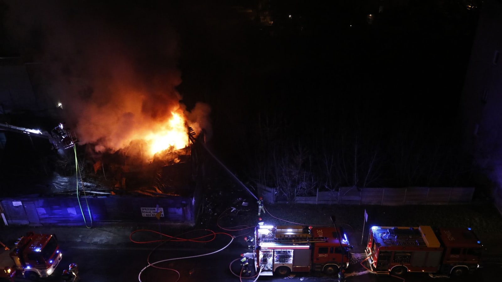
Walloon authorities reopened three roads through the High Fens on Tuesday morning after bringing Belgium’s largest recorded wildfire under control, although smouldering ground fires and extensive forest closures remain.
The fire affected almost 3,000 hectares, disrupted residents, roads, tourism and protected habitats, and required nationwide and international reinforcement. It is now a practical test of whether Belgium can adapt its emergency system to larger vegetation fires.
Updated 25 August 2026, 12:00 CEST — Walloon authorities reopened the N68, N672 and N676 through the at 10:00 on Tuesday, 25 August, after emergency services brought the fire that began near on 14 August under control. The said stopping and parking remain prohibited near the burned area, while speeds are limited to 50 km/h and forests and nature reserves across the , and districts remain closed.
The reopening restores access for businesses affected by the road closures, but it does not mark the end of the emergency. According to the ’s latest operational update, crews dealt with several local flare-ups during the night of 23 to 24 August. Authorities warn that fire can continue to smoulder underground, particularly in peat, while burned trees, residual smoke and exposed wartime munitions make entry dangerous.
Almost 3,000 hectares were affected, according to the Ministry, which deployed about 40 military firefighters and six Panther vehicles. Belgian crews received support from Germany and from aircraft supplied through international and European cooperation. All residents evacuated from Sourbrodt, Küchelscheid and Leykaul had returned home by 19 August, the reported.
The scale of the deployment has opened a wider debate over ’s preparedness for vegetation fires. Federal Climate Minister said the National Crisis Centre will conduct a detailed review of forecasting, information-sharing, coordination, alert systems and operational capacity. His office said the federal government added €850,000 in March to FIRE4BE, a project developing national fire-risk data, modelling, detection and health-impact tools.
Emergency performance and long-term resilience are separate questions. The authorities contained an exceptionally large fire without reporting civilian deaths, yet the operation depended on personnel from across , military equipment and foreign aerial support. A 2025 Walloon climate-adaptation assessment had already identified the and forest edges among priority areas for wildfire exposure.
Water tests near the plateau remain compliant with health standards, according to the , which will continue monitoring for several weeks because contaminants travel slowly through the ground. Officials have not established the fire’s cause publicly. The immediate tests are whether underground hotspots remain contained and when the protected landscape can safely reopen; the longer one is whether the promised post-crisis review produces stronger prevention and response capacity before the next extreme fire season.
Impact
Regional — Eastern Wallonia faces prolonged nature closures, ecological restoration work and disruption to tourism, while public authorities must monitor air, water, unstable trees and underground hotspots.
Local — Baelen and the wider eastern Walloon area face continued disruption despite the road reopenings. Drivers may again use the N68, N672 and N676, but must observe lower-speed, no-stopping and no-parking restrictions. Forests and reserves in the Verviers, Malmedy and Elsenborn districts remain closed, limiting walking, cycling and tourism. Authorities must continue checking underground hotspots, air and water conditions, unstable trees and damage to protected habitats before normal access can safely resume.
International — The response required international reinforcement, showing that a major Belgian vegetation fire can exceed locally available capacity and depend on assistance beyond national structures. For EU and cross-border policy readers, the operational lesson concerns how neighbouring authorities share specialist personnel, aircraft, equipment and situational information during climate-related emergencies. No specific new EU measure has been announced in the article, but the High Fens operation provides a concrete case for reviewing cross-border civil-protection readiness and the speed at which reinforcement can be mobilised.
What it means for you
Drivers can use the N68, N672 and N676 again from 10:00 on 25 August 2026, but should not stop or park and must follow temporary speed restrictions. Visitors should not enter forests or reserves in the Verviers, Malmedy and Elsenborn districts until authorities lift the closures; check Walloon Government and Wallonia Environment updates before travelling. Residents allowed home should continue following official guidance on smoke, water conditions and unsafe trees. Tourism operators and planned visitors should expect cancellations, rerouting and restricted access while hotspot monitoring and ecological assessments continue.
Opposing perspectives
- Fire-service and preparedness advocates
Belgian fire-service representatives and opposition party DéFI argue that limited domestic aerial capacity, staffing pressure and fragmented crisis resources show that Belgium entered the event without sufficient means for a wildfire of this scale.
- Federal review-first position
Federal Climate Minister Jean-Luc Crucke’s office says authorities should first establish what worked and what failed through a National Crisis Centre evaluation, while expanding scientific risk modelling and integrating climate expertise into national preparedness.
Who, where and what
Key people, places and terms in this story
Protected upland landscape where the wildfire burned almost 3,000 hectares.
Belgian region responsible for the affected territory and regional response.
Country in which the largest recorded wildfire occurred.
Municipality near where the fire began on 14 August 2026.
Federal climate minister whose office called for stronger anticipation of climate risks.
Show the full library (15)
Federal climate minister whose office called for stronger anticipation of climate risks.
Protected upland landscape where the wildfire burned almost 3,000 hectares.
Belgian region responsible for the affected territory and regional response.
Country in which the largest recorded wildfire occurred.
Municipality near where the fire began on 14 August 2026.
Forest district where forests and reserves remain closed.
Forest district where forests and reserves remain closed.
Forest district where forests and reserves remain closed.
Wildfire that began on 14 August 2026 and affected almost 3,000 hectares.
Regional authority issuing official information on the fire and access restrictions.
Regional environmental administration providing updates on the High Fens fire.
National institution that reinforced firefighting operations and reported the affected area.
Regional agency whose 2025 adaptation report provides climate-preparedness context.
Federal ministerial office that addressed preparedness following the fire.
News organisation that reported on Belgium’s climate-preparedness debate.
Sources & evidence
- View sourceWalloon GovernmentPrimaryofficial· wallonie.be· 24 August 2026Retrieved 25 August 2026· 39 days ago· Dated
- View sourceWallonia Environmentofficial· environnement.wallonie.be· 23 August 2026Retrieved 25 August 2026· 40 days ago· Dated
- View sourceBelgian Defenceofficial· mil.be· 19 August 2026Retrieved 25 August 2026· 44 days ago· Dated
- View sourceOffice of Federal Climate Minister Jean-Luc Cruckeofficial· crucke.belgium.be· 20 August 2026Retrieved 25 August 2026· 43 days ago· Dated
Related topics
Related to this story
Pulse Insight — This topic connects to 10 associations and 3 funding programmes through the Wallonia ecosystem.
Live connections from the Belgium Impulse ecosystem — not recommendations.
This briefing was prepared with AI assistance and reviewed by a Belgium Impulse editor before publication. methodology.